


BARNSLEY WEST M1 JUNCTION 37
Published 5 September 2025 at 12:23pm
Local Authority: Barnsley MBC
Site: Barnsley West
Opportunity Type: Commercial/Housing
Planning Status: Outline planning permission
Timeframe: 12 months
Presented By: Sterling Capital
Seeking: End users
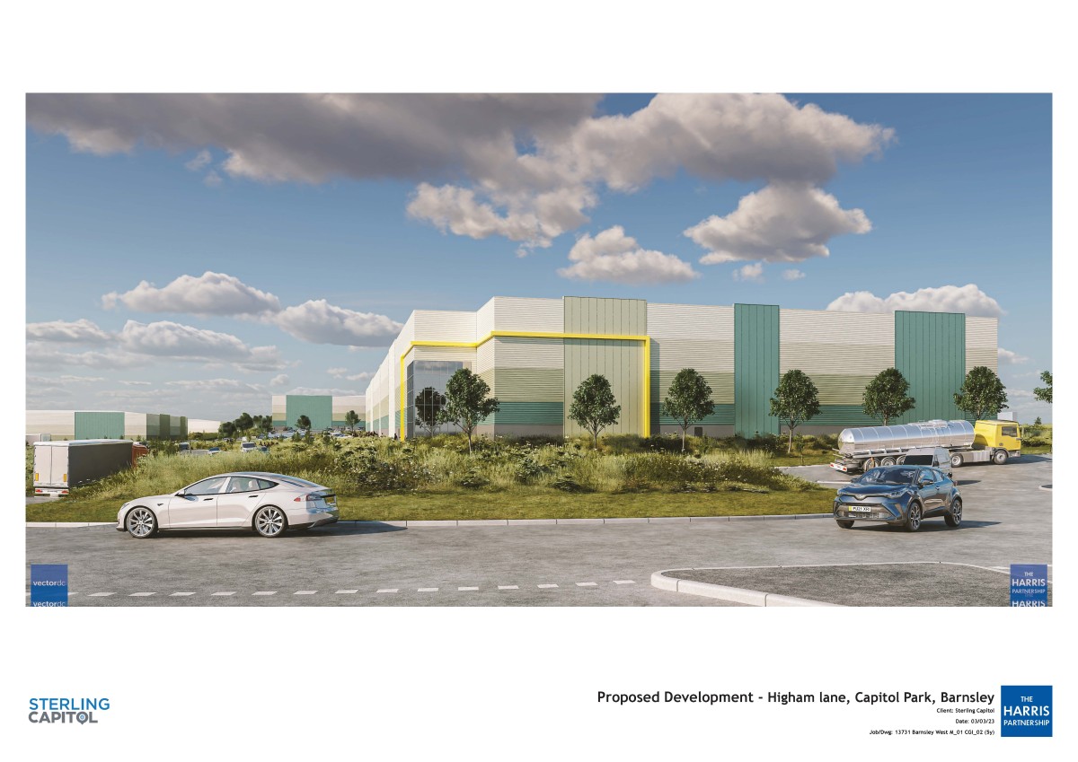
The Barnsley West Masterplan Framework area is located 2km west of Barnsley town centre and immediately north-east of Junction 37 of the M1 motorway. A masterplan framework for the MU1, mixed use allocation site was approved December 2019. BARNSLEY WEST, MASTERPLAN FRAMEWORK (MU1) A strategically important 121-hectares mixed-use scheme that includes 1,700 new homes and 43-hectares of commercial floorspace and is set to create 3,500 new jobs.
There is outline planning permission under reference 2021/1089 to deliver 1.2 million square feet. Can deliver units from 35,000 sq ft up to 500,000 sq ft and have a single standalone plot where it could deliver a 4,500 sq ft convenience store.
The scheme will also build upon the strengths of the existing designated employment sites at J37 and the well-performing employment areas.
INFO & SHARE
Last Updated: 02/10/2025
Published In: Mixed-use
The latest news...
To find all of our press releases and news stories visit our dedicated news section